


One of the central tenets of stream ecology—at least since Noel Hynes’ seminal lecture “The stream and its valley” (Hynes, 1975)—is that the catchment is a primary determinant of the structure and function of its stream. If a stream ecologist or a stream manager is to understand the behaviour of a stream reach, then the most basic first piece of information they need is a map of its catchment boundary, from which they can assess fundamental drivers such as: how much rainfall the catchment receives; the soil and geological characteristics of the catchment; what uses the land is put to. This information is critical to understanding the likely flow regime; itself a fundamental determinant of the physical and biotic form of the stream (Poff et al. 1997). In speaking with my river-manager colleagues at Melbourne Water the other day, I was surprised to learn that they do not have access to a simple system to quickly derive the catchment boundaries of stream and river reaches: reaches that they need to make management decisions on each day. As a result, I’ve built a new tool, the catchment extractor that makes extracting this important piece of information a simple matter (for streams of the Melbourne region). I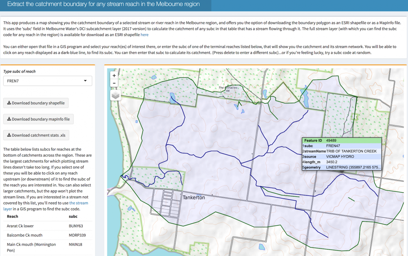 t uses the “DCI” subcatchment layer that is used commonly at Melbourne Water, a layer of ~16,000 nested subcatchments. By entering the subcatchment code (subc) for a reach of interest, the tool merges all of the subcatchments upstream of the reach into a single catchment polygon, and displays it on a map together with lines showing streams up and downstream of the reach. The user can use the displayed map to refine their reach selection (clicking on other stream reaches shows their subc codes). Alternatively, the user can use the DCI stream map*, attributed with a subc for each reach, in a GIS program to select subcs of interest. When the user is happy with their selection, they can download the polygon either as an ESRI shapefile or as a MapInfo file. The tool also allows the download of a table of summary catchment statistics for the reach (as used in the LUMaR package).
*Update: Jan 2020 – the catchment extractor app has subsequently moved and been superseded by the Melbourne Water Stream Network app (which also provides links to an improved stream network spatial layer. The link above still points to the legacy stream layer). I have changed the link above to point to this new app.
References
Hynes, H.B.N. (1975) The stream and its valley. Verhandlungen Internationale Vereinigung für Theoretische und Angewandte Limnologie, 19, 1–15.
Poff, N.L., Allan, J.D., Bain, M.B., Karr, J.R., Prestegaard, K.L., Richter, B.D., Sparks, R.E. & Stromberg, J.C. (1997) The natural flow regime. BioScience, 47, 769–784.