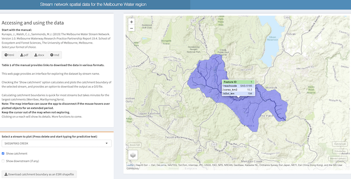
Category: GIS
Definitive Melbourne stream network now available
It’s been a long time between posts (I’ve been away for much of the year: more on that later). This return to the blog is to announce the completion of the Melbourne Water Stream Network v1.0, now available at tools.thewerg.unimelb.edu.au/mwstr/*. The stream network is a spatial database, comprising a stream…
Delineating catchment boundaries made easy
Definitive Melbourne stream network now available
![](/wp-content/uploads/sites/3/2019/12/Screenshot-2019-12-11-11.34.09.png)
It’s been a long time between posts (I’ve been away for much of the year: more on that later). This return to the blog is to announce the completion of the Melbourne Water Stream Network v1.0, now available at tools.thewerg.unimelb.edu.au/mwstr/*. The stream network is a spatial database, comprising a stream…