


This site previously housed interactive apps for the analysis and management of stream ecosystems, developed by members of the Waterway Ecosystem Research Group at the University of Melbourne, for the Melbourne Waterway Research-Practice Partnership. The apps have moved (here), but are described below.
Environmental Benefit Calculator (for stormwater management)
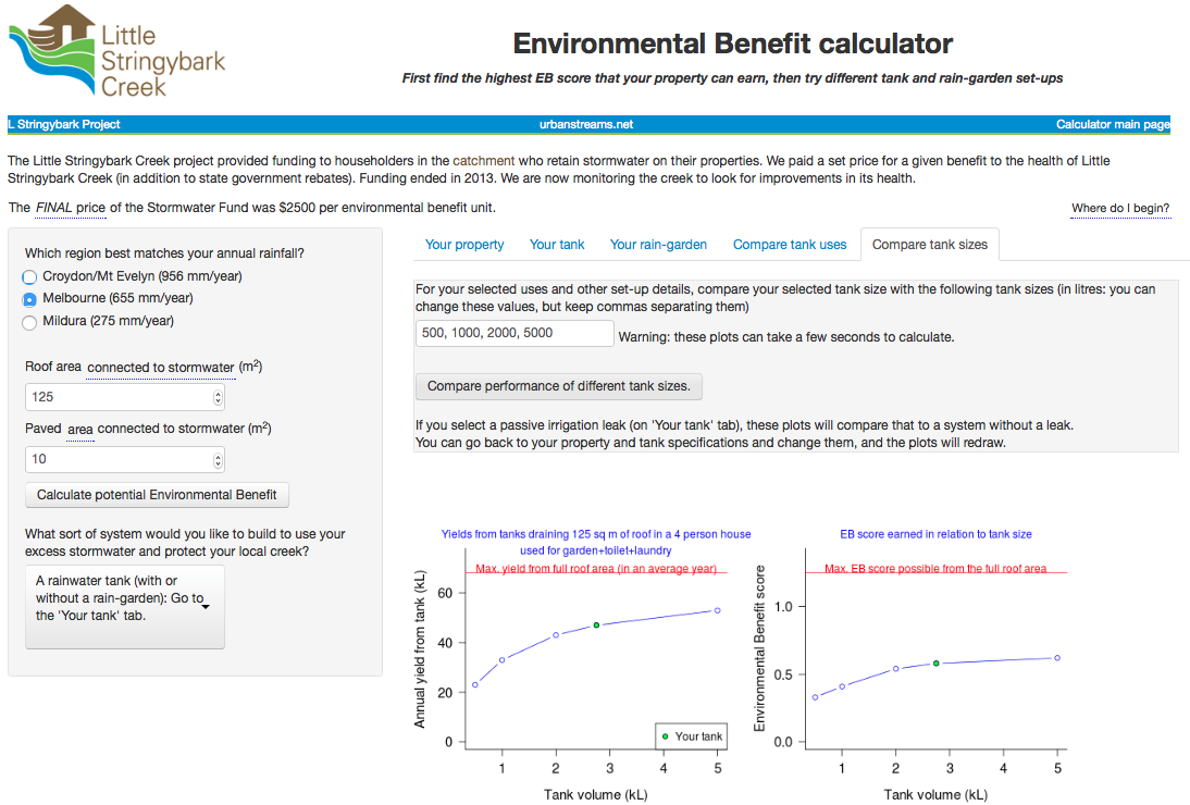
Get the most out of your rainwater tank or raingarden. Use this tool to find the optimal design for harvesting the water you need while providing the maximum protection for your local creek. (Originally developed for the Little Stringybark Creek project, the tool has been updated with some new features, such as an option to select a rainfall pattern for your area). (by Chris Walsh)
Stream network and catchment extractor
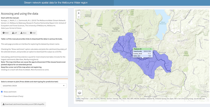
One of the most basic pieces of information that you need to understand a stream is the extent of its catchment. This tool, which replaces the old catchment extractor tool, allows interactive exploration of the latest Melbourne stream network map. You can calculate the catchment boundaries of all stream and river reaches in the Melbourne region and download the boundary polygon for use in GIS software. (by Chris Walsh)
Melbourne Water macroinvertebrate database
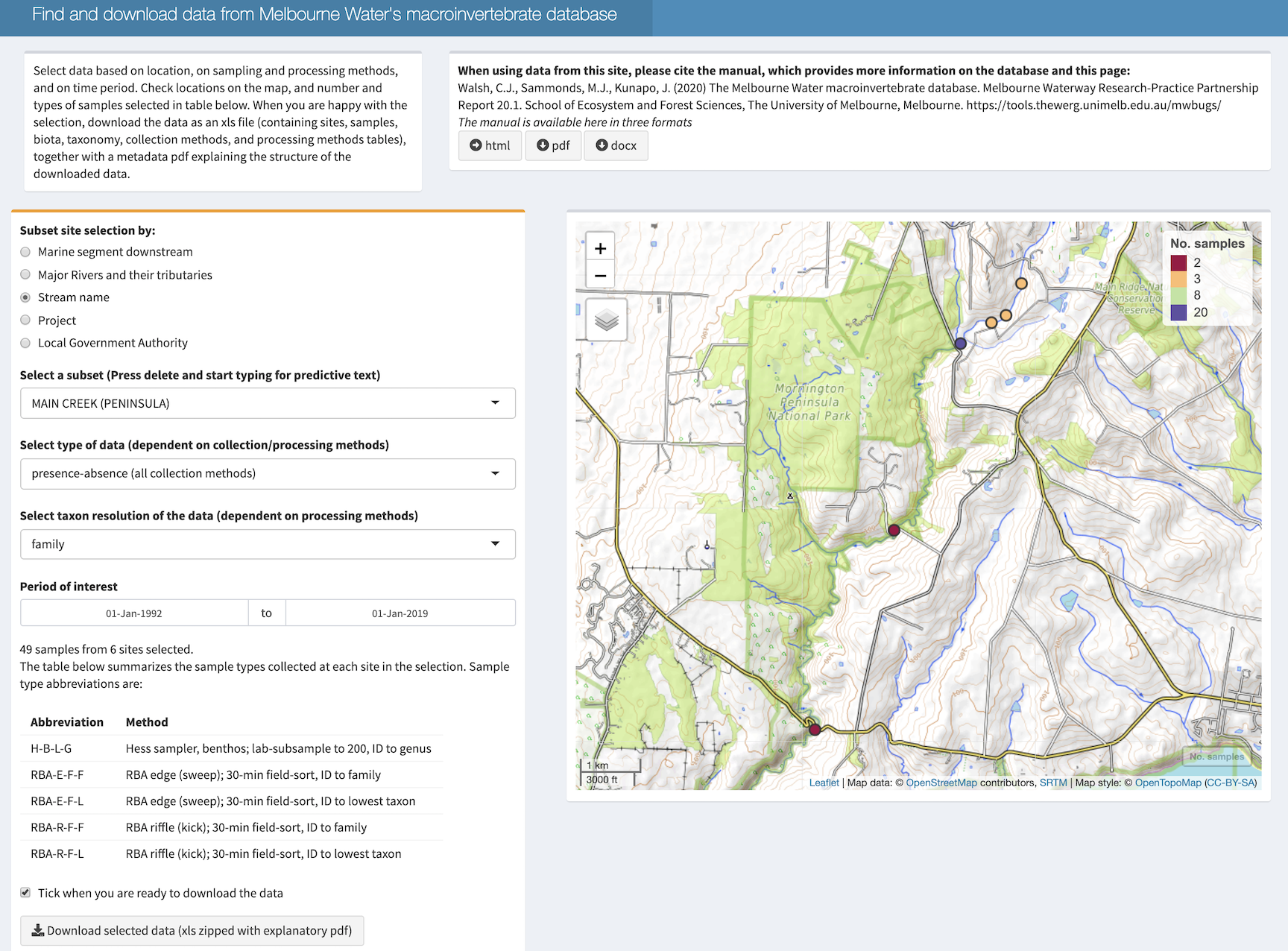
An open-access, searchable web interface for Melbourne Water’s large collection of macroinvertebrate assemblage records from streams of the Greater Melbourne region since 1993, integrated with the stream network (by Chris Walsh).
The baseflow estimator
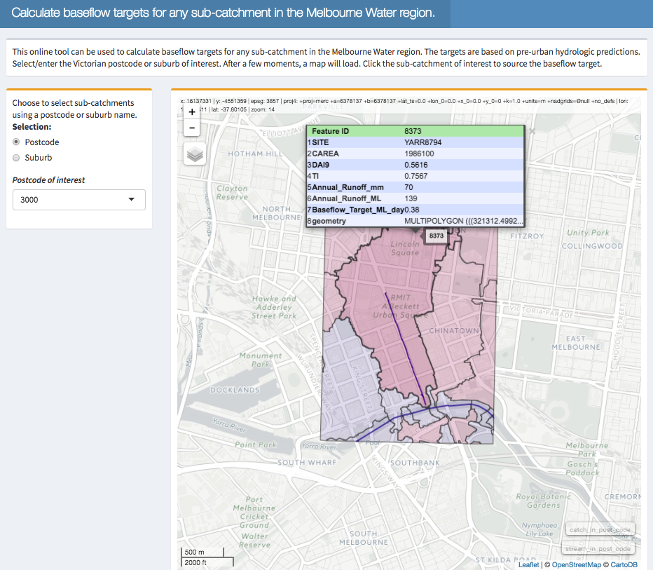
Urbanization messes with the volumes of water flowing out of catchments. How much baseflow should we be aiming for for a particular stream? This tool reports pre-urban mean annual and daily streamflow (good estimates of baseflow) for any drain or stream catchment in the Melbourne region. (See this post for more details.) If you want to know more about how urbanization increases annual flow volumes (and how much stormwater we should be harvesting) have a look at this page. (The baseflow estimator is by Matt Burns)
Macroinvertebrate assemblage prediction
Which bugs would you expect to find in a particular stream reach? This tool uses the family distribution models developed by Walsh and Webb (2013) to predict assemblage composition (a good indicator of stream health) in reaches across the Melbourne Water region, and allows the user to ‘change’ urban and tree cover upstream of each site to make predictions of the effects of possible management actions. The tool is still in development. (by Chris Walsh)
The LUMaR calculator
This tool, related to the macroinvertebrate assemblage prediction tool, allows you to upload your own macroinvertebrate data (from the Melbourne region) to calculate LUMaR score, a new indicator of stream condition, developed by Walsh and Webb (2013), that provides improved, consistent assessment of urban and forest-loss impacts across the Melbourne region. (by Chris Walsh)