It’s been a long time between posts (I’ve been away for much of the year: more on that later).
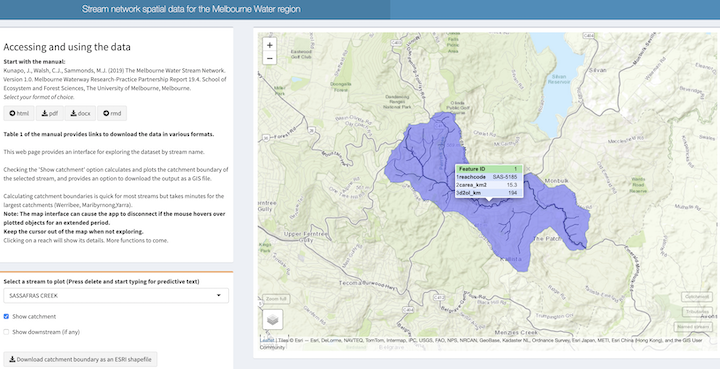
This return to the blog is to announce the completion of the Melbourne Water Stream Network v1.0, now available at tools.thewerg.unimelb.edu.au/mwstr/*.
The stream network is a spatial database, comprising a stream lines layer and subcatchments layer with a data structure that allows for rapid compilation of network relationships, for quick estimates of things like catchment statistics. The user’s manual, also available at tools.thewerg.unimelb.edu.au/mwstr/, explains all.
The mwstr app allows exploration of the ~127,000 individual reaches on the ~30,000 streams of the region. (Only ~1500 of those streams had names before this project, and many shared the same name, but they all have unique names and stream codes in this database). You can download the catchment boundary of any stream of your choice, and also plot the full length of river downstream (if there is any).
This app replaces the catchment extractor app: more accurate stream lines and catchment boundaries, better functionality.
*Links updated 30 December 2019. See next post for why.


